Clarks Summit Trail Ride
Get OUTSIDE
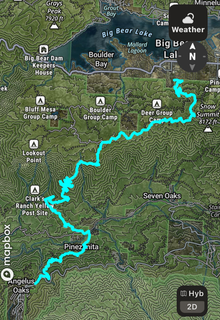
Clarks Summit - 05/22/2026
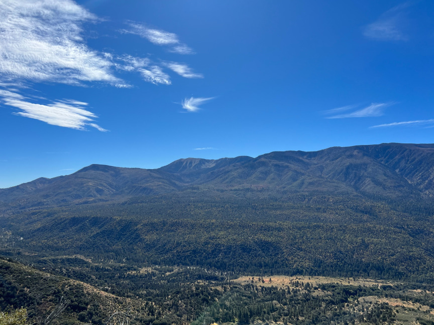
Men bring your families and come and join us on Friday, May 22nd on this 18 mile trail exploring the back side of Snow Summit Ski Area. The upper portion of Clarks Summit offers spectacular scenic lookouts and views of Sugarloaf Mountain, the highest point in the San Bernardino National Forest. This trail is only for street-legal vehicles. There are some narrow sections, but the road is typically well-graded. Trail ends in Big Bear where we will be eating lunch for any who want to join.
For those of you who want a bit more adventure - After the trail ride we will be camping in Holcum Valley Campground or find a spot for some dispursed camping. If you are interesed in camping with us, please let me know on the registation form and I can send you more info.
You can drive your own 4x4 or you can ride with someone. Please use the signup link above and let us know if you are going to bring your own rig or you would just like to ride. Please note: each participant needs to register, whether you are driving or riding. Upon signing up we will follow up with an additional email detailing the trail route, gear, radios, etc...
Trail Statistics:
18 miles
3400 elevation gain
2260 elevation loss
Difficulty rating 3-4 (Scale of 1-10)
Easy to moderate
Uneven rutted dirt trail with loose rocks, sand, erosion, and washes.
Possible shallow water crossings, small ledges and short steep grades.
One area with larger rocks to navigate through (softball - basketball sized rocks)
Start - Angeles Oaks
End - Big Bear
Schedule
7:30am - Meet in church parking lot (611 E Cypress Ave, Redlands, CA)
7:45am - Trail/Safety Briefing
8:00am - Caravan to Angeles Oaks and trail head.
- Air down 15-20 minutes —
- Start trail
Directions to trail head
Take highway 38 to Middle Control Road - just past Angeles Oaks. MCR takes off from a turnout on the north side of the road. Take MCR to Seven Oaks/River Road. Turn left and stay to the right to access 1N54/Clarks Summit.
Please Note: This trail is in the San Bernardino National Forest.
You will need an annual or a day Adventure Pass.